It’s good to see that this dataset has been updated. I’ve only had time to give it a quick glance but the errors I (we) spotted do seem to have been corrected.
I’m told that RPUK will be updating their maps in due course.

Standing up for Nature

It’s good to see that this dataset has been updated. I’ve only had time to give it a quick glance but the errors I (we) spotted do seem to have been corrected.
I’m told that RPUK will be updating their maps in due course.

Comments are closed.
This really is good to see and shows that your blog is being monitored. Well done to you, Anand et al.
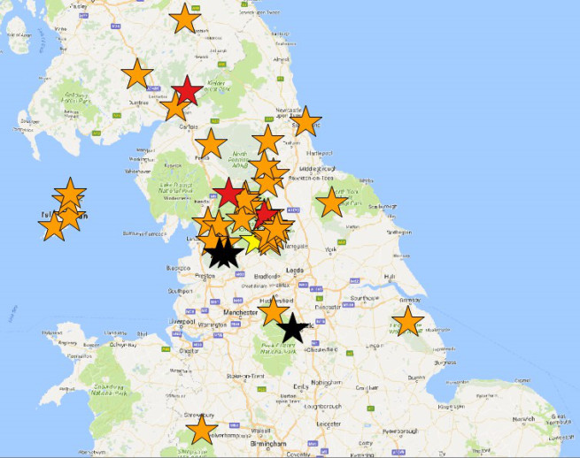
Since we got the corrected data, although I think I have found an error in the radio tracked data but still its pretty good. I have plotted the last fixes of both satellite tagged and radio tagged birds it shows even “worse” clustering. There are 9 satellite tagged birds with last fixes south of Wensleydale and east of Waldendale ( grouse moor areas) in the YDNP and into Nidderdale AONB (5 here) in the same area there were last fixes for 10 radio tagged birds. There is a particular concentration on the ridge that forms the western boundary of the AONB between Great Whernside down to Beamsley Beacon and Blubberhouses Moor. Along this ridge there are 13 radio and satellite last fixes. there are three fixes on what are known as the East Nidderdale moors to the east of the Nidd and one almost in the Nidd north of Lofthouse village.
There are also six fixes on the grouse moors on the plateau between Wensleydale and Swaledale another area of grouse moors. This certainly doesn’t look like chance.