
Nick MacKinnon is a freelance teacher of Maths, English and Medieval History, and lives above Haworth, in the last inhabited house before Top Withens = Wuthering Heights. In 1992 he founded the successful Campaign to Save Radio 4 Long Wave while in plaster following a rock-climbing accident on Skye. His poem ‘The metric system’ won the 2013 Forward Prize. His topical verse and satire appears in the Spectator, and his puzzles and problems in the Sunday Times and American Mathematical Monthly. Email: nipmackinnon@gmail.com
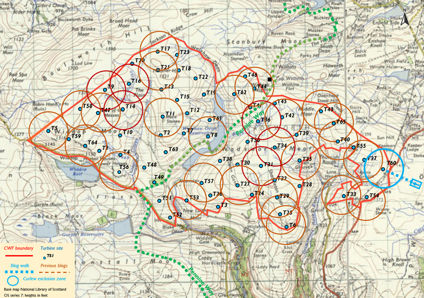
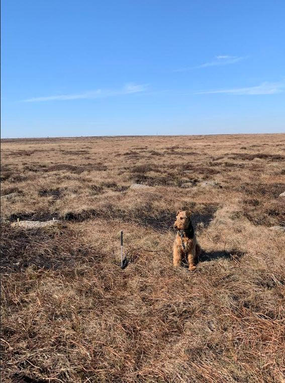
Turbine 60 Cock Hill Swamp SE 01062 32897 ///highlighted.technical.trackers
We’ll use the Turbine Delivery Route Assessment for the Carrownagowan Wind Farm (19 turbines, 90 MW so 4.7 MW turbines) as a guide to the delivery of blades, nacelle and pylon sections to CWF (65 turbines, 302 MW so 4.6 MW turbines). The Irish solution allowed the blades to travel horizontally from Galway Harbour. Specialist trailers can raise the blades up to 60° to pass constricted bends and this has been done at two UK wind farms. We’ll consider this technology once we have shown that neither CWF site entrance (Clough Foot or Cock Hill) can be reached on public roads without raising the blades.
-
“The analysis has been carried out for a 68-metre-long turbine blade. The bottom tower section is likely to have a flange diameter of up to 4.5 metres. A load height of 5 metres has been assumed for the tower sections.” (page 2)
-
“The standard clear area for manufacturers of this class of turbine is 6 metres wide.” (page 4)
-
“In the final approach the route is relatively straight but is narrower than the clearance required by turbine manufacturers. The road width is also less than the minimum 4.50 m to 5.00 m for this class of turbine.” (page 30).
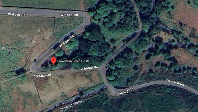
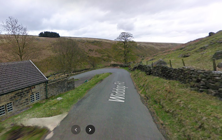
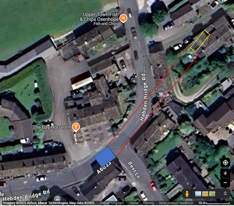
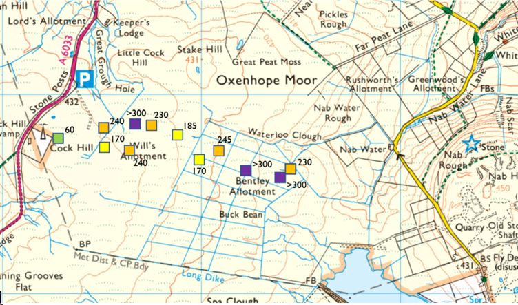
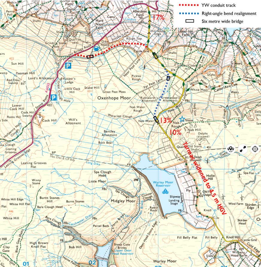
Since the earliest blogs, we have known the sole site entrance to the 302 MW CWF of the withdrawn 2023 Scoping Report was at Cock Hill on the A6033. This information came from a mole close to Richard Bannister called ‘Deep Stoat’. Now we are waiting for a new application after the 2023 version and its website was shredded in these blogs. The West Widdop road to Clough Foot seems to some the most natural approach to the site and might allow a less destructive cluster on the Heather Hill massif alone. Our first job is to dismiss the Widdop Road and then we can discuss the pinch points from other directions. The map below shows the six key access points for Walshaw Moor.
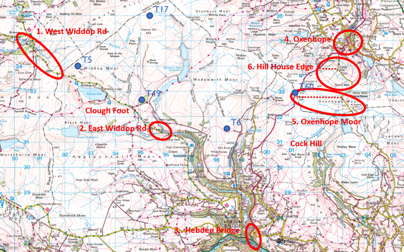
- The West Widdop road
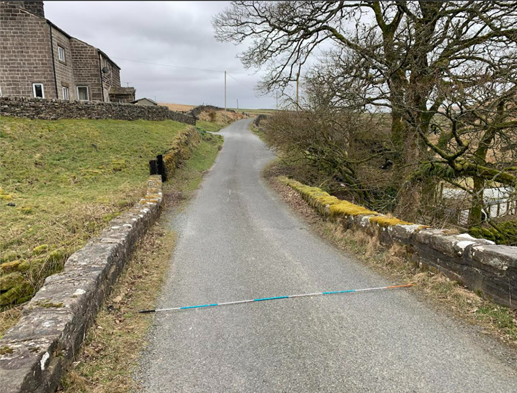
The rather spectacular route is shown in the photograph below. There are many sections of three metres width. The photographs show the road terrace would have to be widened to 6 metres and the running surface to 4.5-5 metres and that it will be expensive, destructive, and dangerous.
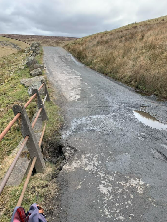
One point of using the Widdop Road might be to build a less destructive (50 MW?) wind farm on the grazing above Clough Foot, but such a low power cannot carry the cost of the civil engineering to the road nor the trenching to connect at Rochdale, so is self-defeating.
- The East Widdop Road
The East Widdop Road is blocked for turbine deliveries of all kinds by the formidable Blake Dean hairpins.
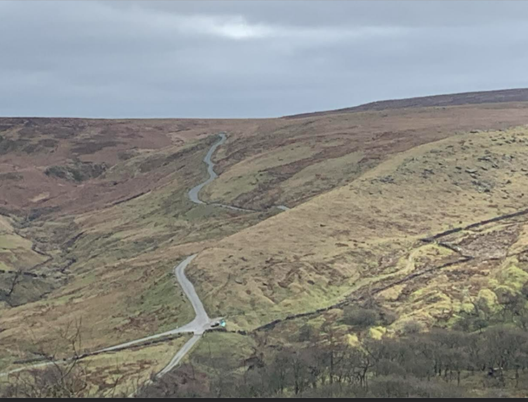
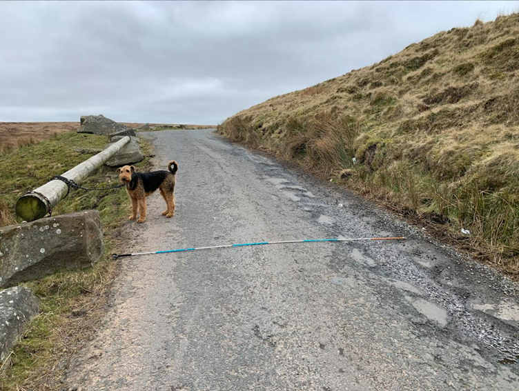
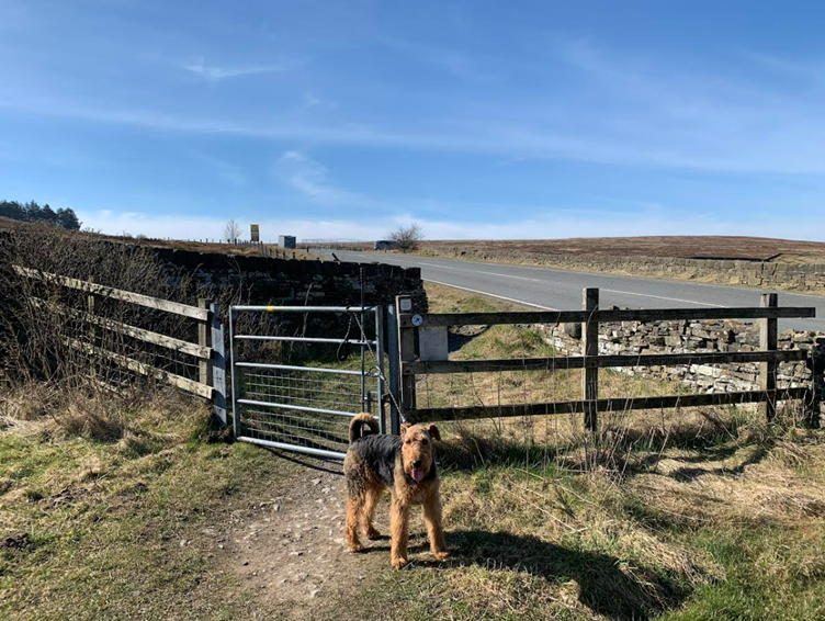
An enthusiast for CWF told me a dinky wind farm can be built out of Clough Foot that might even be less polluting than the grid mix in 2030. They were contemptuous when asked for the width of the Widdop Road, so now the dog and I have measured it for them.
- Hebden Bridge end of the A6033
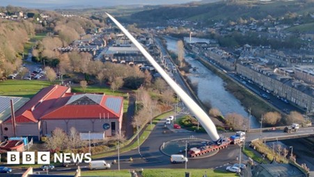
With the Widdop Road dismissed, we turn to the A6033. Delivery is via Sowerby Bridge and there are bound to be multiple pinch points before the turn north. Entry into Hebden Bridge must be from the east on the A646 to avoid the jack-knife junction. The decisive obstacle is Nutclough corner, whose built-up narrowness is presently managed with traffic lights and double yellow lines on both sides.
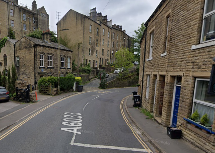
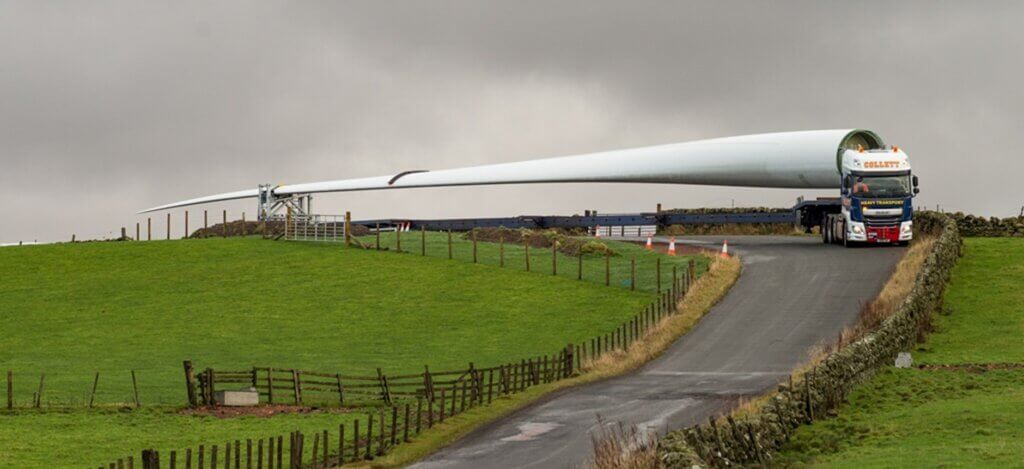
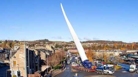
If they want to get a 68-metre blade round Nutclough bend, they will have to raise it to 60°. Raised blade delivery has its uses when delivering in forestry, and Windy Rigg (43 MW) above Ayr, where the blades were landed, is an excellent example. The other is Pines Burn (49.9 MW) through the middle of Hawick and was a terrible imposition that must not be repeated if onshore wind is to retain consent. Comparison of the masonry-bound streets of Hebden Bridge and the wide boulevards of Hawick is instructive. Far more onshore wind power than we can ever use can be built without the insult to deprived communities of raised blade deliveries. Pines Burn WF was developer greed that should have been stamped on by the Scottish Government.
- Oxenhope
Blade access from the motorway to Oxenhope is via the middle of Keighley and there are bound to be multiple pinch points. In Oxenhope, the most notable is the right-angle at The Bay Horse. A similar problem occurs round the church, and the tight hairpin above is also impassable with a horizontal blade.
We conclude that delivery up the A6033 through Oxenhope or Hebden Bridge would require raised blades. There is an excellent account of the problems in Hawick by Philip Kerr. A schedule that was meant to deliver the first seven blades in 17 days took 85 days because the wind speed (below 10 m/s or 25 mph), daylight, and police escort availability were hard to synchronize. Chaos in the wide streets of Hawick was caused by just 33 blade deliveries. 302 MW CWF requires 195 blades. I don’t know if raised blades go round the Nutclough bend, but it will be much harder than Hawick.
- Ovenden Moor Wind Farm to Cock Hill via Oxenhope Moor
What distinguishes mathematicians from engineers is our love of existence theorems. These establish “something is there” without being explicit about the something. The greatest is the oldest; Euclid’s proof that there are infinitely many prime numbers. “Assume a finite list of all primes. Multiply them together and add one. The number made is divisible by a prime not on the list.” Mathematicians say to themselves at 13, “I want to work where Euclid’s proof is the line of beauty.” For two thousand years we have solved deeper prime number problems (How regular? How dense?) but Euclid proved there was something there and everyone can meet the proof at school.
When I started this investigation, I gave an existence proof that Calderdale Wind Farm could be accessed from Goole: “Turbines were delivered to Ovenden Moor Wind Farm, and a moorland track can be built from OMWF to Cock Hill.” I once had a sofa moved up a stair. Soon it was wedged. Mr Russell said, “If it moves a centimetre, it isn’t stuck.” He then accumulated these centimetres in all three dimensions, and 10 minutes later it was in. Mr Russell had an existence theorem too. “It isn’t hard to take out a sash window and haul up on a rope, but we always try the stairs first.” I wasn’t saying Ovenden Moor was the route; it was to dispel the claim that “Turbines cannot get onto Walshaw Moor” which would have left us laughing on the battlements until Christopher Wilson blew the doors off. In the siege of Hebden Bridge, the Lord of the Nazgûl may block the roads before he floods the town.
Detailed analysis could be delayed until I understood the terrain. Now at halfway, it is time to get stuck in. Swept path analysis is difficult, and I’m not claiming any expertise, but I am certain the Nutclough and Bay Horse bends seal off the A6033 for horizontal blade delivery. We have now proved that the only way to get horizontal turbine blades onto Walshaw Moor is via Ovenden Moor WF. We have tried the stairs, so we take out a window and haul up on a rope.
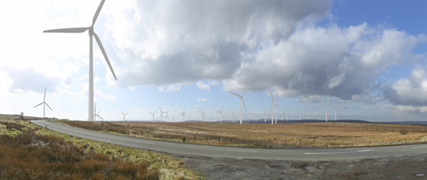
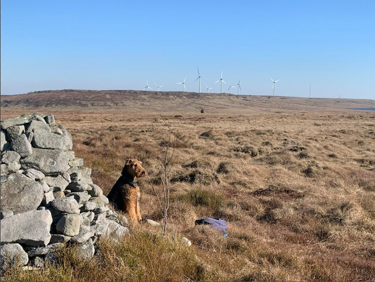
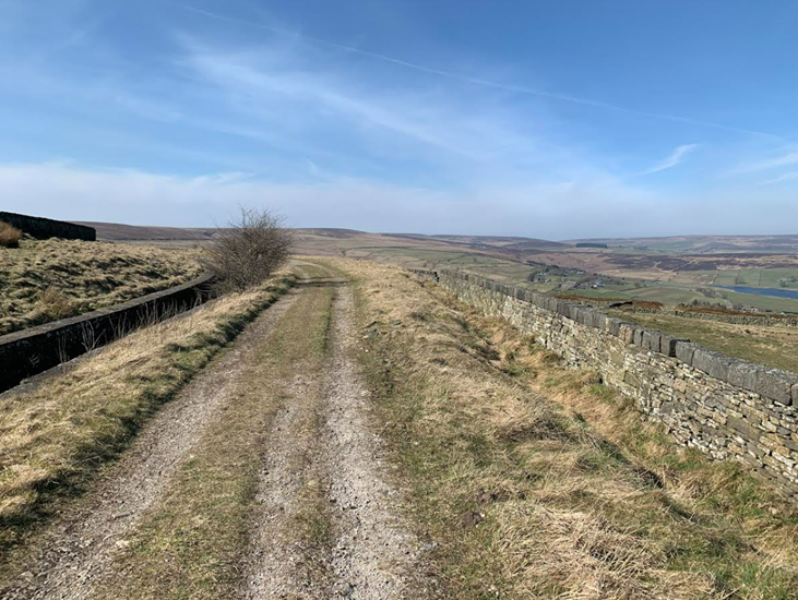
Compared to the routes we have looked at so far, getting from the M62 to Ovenden Moor is straightforward. There is a large factory making lithographic plates in the middle of rural-seeming Wainstalls, on the site of a mill staffed by Liverpudlian orphans whose descendants still live in Calderdale. HGVs can pass each other on Pellon Lane between Wainstalls and Halifax and turbine deliveries would be made at night when there is little traffic in Halifax, home of Collett & Sons, the delivery experts. All the difficulty is in the four kilometres, as the curlew flies, from OMWF to Cock Hill. In this section we try going over Oxenhope Moor.
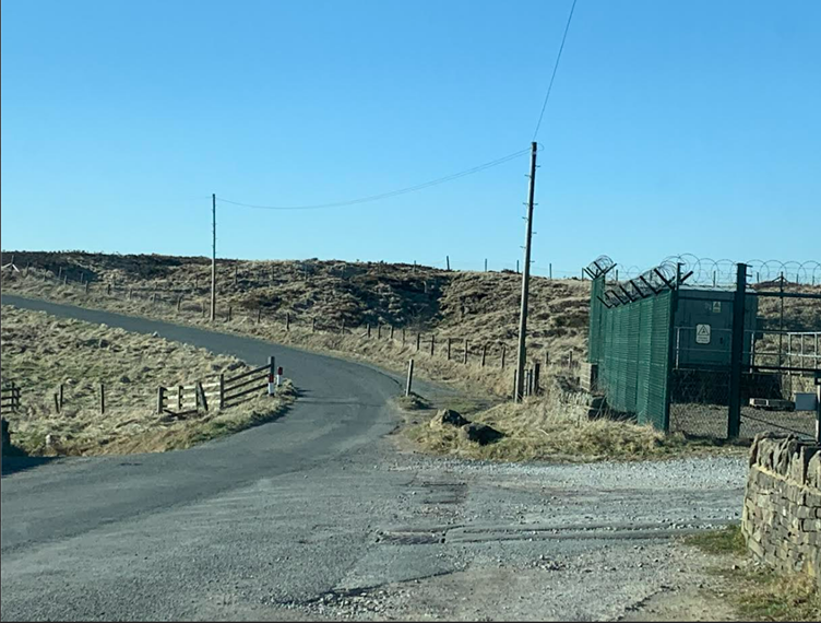
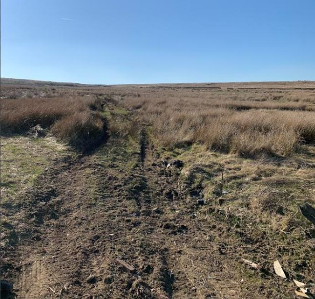
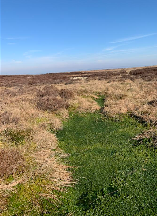
On a wonderful day the dog and I set off from the Nab Water corner on a bearing for Cock Hill mast. The rough track shown is in the right direction and it becomes a faint but worthwhile path that leads to a bit of fence that is down. The moss on the way up is rampant and on top the avalanche probe fails to find the bottom for the first time.
The Yorkshire Peat Partnership have taken the whole plateau (Oxenhope, Warley and Midgley moors) in hand and have made a start on restoring the active bog. Their superb work is already winning. When you walk through this success story, you know that no rubbishy CWF aggregate track is coming this way. The high-quality drainage blocking and the speed of bog improvement on Oxenhope Moor shows that Walshaw Moor (weak turf dams in some grips) is not being rewetted fast enough. It would be Dalek-hearted ecocide for the Walshaw Moor owners to demand an access track across this wonderland and Bradford and national planners will reject after a two-year study of the nesting red-listed birds. The planning committee meeting would go something like this.
“Now Mr Bannister, let me see if I have this right. You own a Calderdale grouse moor that is not recovering quickly from well-documented … indiscretions in the past. You are asking Bradford Metropolitan District Council for permission to bulldoze a two-lane aggregate track and associated drainage ditches into Oxenhope Moor, destroying spectacularly successful blanket bog recovery funded by Defra, Environment Agency, Esmée Fairbairn Foundation, National Lottery Heritage Fund, Natural England, Yorkshire Water, and Yorkshire Wildlife Trust, with the support of the NFU and the Moorland Association, of which you are yourself a member. Your track’s purpose is to convey machinery and aggregate to dry out the peat on your own Walshaw Moor, a Special Area of Conservation and Special Protection Area, protected by international habitat regulations which the Deputy Prime Minister has stated are, in her opinion, not made less effective by her Planning and Infrastructure Bill, 2025. You intend the electricity generated to be sold in West Lancashire at a price set for fifteen years by gas and to this end you will picket Wuthering Heights and the Haworth Parsonage, places that celebrate three of the most famous women in the history of the world, with 200-metre-tall wind turbines. Is that your position?”.
The walls are closing in on CWF horizontal turbine access. There is one more possibility.
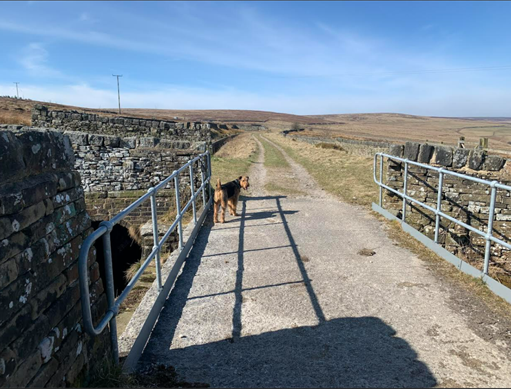
- Hill House Edge
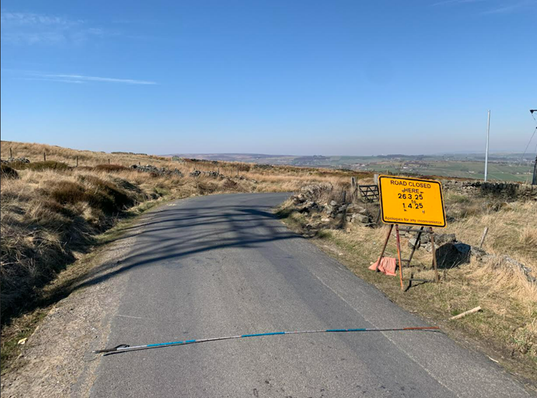
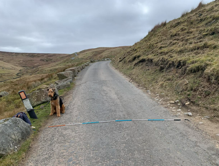
The minor road that links Ovenden Moor WF to the A6033 above the Oxenhope hairpin deteriorates further beyond Nab End, after which it is called Hill House Edge. It descends steeply along Nab Water by two right angle bends and crosses Paul Clough on a narrow embankment before it reaches the moorland edge at the Oxenhope mast. As the photograph above shows, the running surface is three metres wide. Beyond the bend in the photo, the road charges down at 17% and meets the A6033 at a T-junction. This north-facing road is notorious for ice and first to be closed each winter. It is signed “Unsuitable for HGVs”.) The turbine deliveries must meet the A6033 at an obtuse angle, so they are not steamin’ and arollin’ down Hill House Edge like Casey Jones at the throttle of the Cannonball Express.
Two routes bypass the Cannonball Run. A line across Rough Top into Intake Lane, a rutted grass track between dry stone walls, meets the A6033 at the Waggon and Horses, so it won’t do.
The last chance for CWF leaves the road above the mast, crosses some unfenced grazing, and then joins an existing limestone aggregate track along the conduit to the A6033. This may be a plausible route if Yorkshire Water and Bradford Met permit it. (“Now, Mr Bannister…”) Yorkshire Water are among the bodies who pay for Oxenhope Moor rewetting so it would be unexpected for them to hand over their asset to a company who are going to dry out Walshaw Moor, bringing forward the catastrophic flood for which Yorkshire Water will be blamed. The specific position of YW on Calderdale Wind Farm is not known because they did not engage with the Scoping Report but their position on peat wildfires could not be clearer.
Readers will be relieved to know that the millionaire owner will not have to pay for this substantial off-site road, which will be charged to electricity bill payers by a pension fund who will receive an income from our indentured grandchildren. Privatise the profits: socialise the costs.
Ideally the stone deliveries would use the same approach as the turbines. This only works if the limestone quarry is east of the site, with the least bad being Darrington. Since two 28-tonne artics cannot pass on the 5-metre-wide road from OMWF to CWF, they must travel in convoy. The delivery rate for 302 MW CWF is formidable, at up to 9 lorries per hour for a year during track building. Since OMWF-Cock Hill-OMWF (15 mph, 20 minute turnround for tipping) takes at least 45 minutes, there should be seven lorries in each convoy, part of a fleet of 35 strung out between Darrington and Cock Hill, with two convoys always going in opposite directions in stop-start traffic through Halifax, and two more on either side of the M62. If the stone cannot come from Darrington and other magnesian limestone quarries at a similar distance to the east, then CWF may be doomed on stone alone. CWF needs a lot of limestone fast, and Darrington will price accordingly.
It all depends on how much destruction and disturbance this bizarre project is to be permitted. It is only happening because Richard Bannister wants to get shot of his grouse moor. If climate change were the driving factor, we would demand that he rewets his moor as fast as possible rather than drying it out with a wind farm. 302 MW CWF will emit carbon dioxide at three times the grid mix rate in 2030 and will therefore increase atmospheric CO2, but the immediate risk is floods and a sudden huge CO2 release in fire as part of the peat tipping point. The strongest argument against wind farms on peat is that they will accelerate global heating in the feedback vortex from the wildfires that are beginning to encircle the Arctic at our latitude. Calderdale Wind Farm is huge and destructive, but the campaign against is an opportunity to highlight the urgent need to protect our peat and reestablish peat formation.
That’s it. It is not enough that the SAC and SPA on Walshaw Moor are destroyed. We must sacrifice yet more to satisfy Richard Bannister’s greed because his grouse moor is walled with towns, reservoirs, steep edges, and trenched valleys. There will not be Dalek-hearted ecocide on Oxenhope Moor because there’s enough of that on Walshaw Moor already to sicken Ed Miliband. If he decides to pass CWF after its inevitable rejection by the Planning Inspectorate, he either (i) demands that Yorkshire Water hand over their asset so that the billpayers can buy Mr Bannister a dream for Christmas; or (ii) he orders Hebden Bridge citizens to park their cars in the vast empty car parks for which their town is famous, and brace themselves for 195 raised blade deliveries driven round the Nutclough bend; or (iii) he tells Christopher ‘440 Kelvin-Volts’ Wilson to use a helicopter and send the bill to Richard Bannister.
++++++++++++++++++++++++++++++++++++++++++++
This is the 32nd in a series of 65 guest blogs on each of the wind turbines which Richard Bannister plans to have erected on Walshaw Moor. Turbines 5, 6, 8, 9, 11, 14, 16, 17, 21, 25, 27, 31, 32, 33, 34, 35, 36, 37, 40, 42, 43, 44, 47, 53, 54, 56, 57, 58, 62, 64 and 65 have already been described. To see all the blogs – click here.
[registration_form]
An excellent blog which really should be sent to each and every councillor and MP in the areas that would be affected by this if it went ahead. That should include those for the areas that are not just affected by the turbine farm itself, but also the various transport access routes for the stone and the turbines.
On reading your blog, even a blind man should be able to see the numerous and very valid arguments against this development.
This is such an entertaining, well-researched read. I hadn’t even thought about how they’d get them there! Very thoroughly explored, lots of food for thought. Depressing and funny at the same time. Loved the photographs and dog for scale, thankyou.