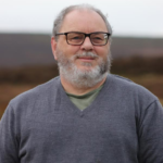
Nick MacKinnon is a freelance teacher of Maths, English and Medieval History, and lives above Haworth, in the last inhabited house before Top Withens = Wuthering Heights. In 1992 he founded the successful Campaign to Save Radio 4 Long Wave while in plaster following a rock-climbing accident on Skye. His poem ‘The metric system’ won the 2013 Forward Prize. His topical verse and satire appears in the Spectator, and his puzzles and problems in the Sunday Times and American Mathematical Monthly. Email: nipmackinnon@gmail.com
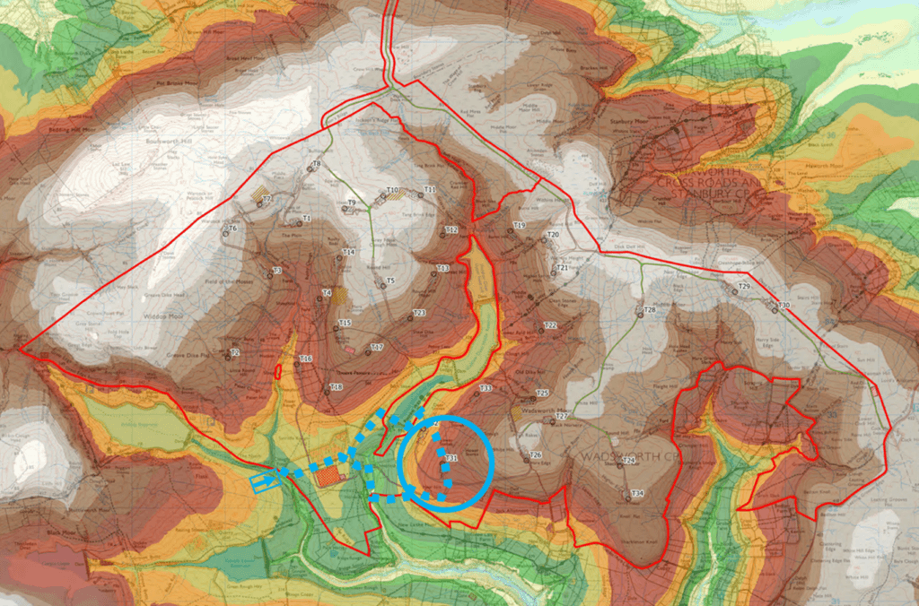
Turbine 31 Hoar Nib SD 96325 32476 ///silly.restored.rolled
Welcome to Season 5 of Walshaw Turbines! The statutory consultation is finally closed after an extra month caused by incompetence at Cavendish Consulting, Algihaz’s PR gurus. The next communication from Christian ‘the Eagle’ Egal, Project Director of Calderdale Energy Park, and the Inspector Clouseau of Renewables, will either be a Direct Consent Order (DCO) submission in “November” (it should be December after the month-long Cavendish cock-up but it’s always rush rush rush at CWF Ltd) or a white flag from the investors Algihaz, who have suffered enough.
The DCO submission is made to the Planning Inspectorate (PINS) and there is a 28-day gate in which PINS make a binary decision to accept or reject the application for examination. The gate decision is not based on the merits of the CEP itself, but on the adequacy of consultation. Rejection at the gate would be fatal to CEP and a blow to the reputation of Algihaz, whom we have advised to desist. The subsequent examination will be prolonged because the process has been so incompetent, and this is why PINS have the option to reject at the gate. It stops a fatberg downstream if you don’t flush wet wipes down your toilet.
Calderdale Council make the point clearly and forcefully.
“The council considers that the consultation has not been carried out on an adequate basis. In particular, the scale of errors, omissions, and inconsistencies, coupled with the piecemeal and evolving nature of the information provided, has prevented the council from understanding the proposed development and its likely impacts, and from engaging in a meaningful and informed way.”
The World Cup is over, and one of the most disturbing aspects, in what was mostly a superb tournament, was the behaviour of the Argentina team against England and Spain. Their continual fouling was designed to break up the play of more fluent opponents, and they reckoned the referee would not issue yellow or red cards before half time because Lionel Messi was too big to fail. This reluctance to regulate creates moral hazard. Bad people take advantage of moral hazard. We saw the same in the early 2000s before the financial crash, when our illusory prosperity and generous public spending under Blair-Brown-Mandelson (“the end of boom-and-bust” and “we are intensely relaxed about people getting filthy rich”) was built on the same “too big to fail” moral hazard for the investment banks.
The Planning Inspectorate may be similarly reluctant to reject CEP at the gate (too big to fail) despite the unprecedented depth of documented incompetence in the consultation materials. The consequence of overlooking this incompetence now would be a grimly contentious examination of CEP that will damage the national interest, the Net Zero policy, and the reputation of Algihaz. If CEP is waved through the gate, future DCO proposals will be immune from the consequences of indiscipline, like Lionel Messi and his compadres, and this is moral hazard. It would be unfair to the reputable companies who play by the rules to allow the inadequate and incompetent CEP through the gate. Whether Algihaz are such a reputable company remains to be seen.
20 July 2026 It’s too hot for the dog, so I go alone to the southern crossing of the Walshaw Dean divide, where fences and walls obstruct an Airedale terrier going about his shadow audit of Calderdale Energy Park.
This blog recently covered the northern crossing of Walshaw Dean by the Stanbury Bog Expressway. Without a Walshaw Dean crossing, CEP becomes two separate wind farms. When I asked Donald ‘Transparent’ Mackay why he wanted two crossings he said, “I always double up. Maybe they won’t let me have Alcomden Water bridge.” The expansion of the red line to accommodate the Expressway is an unconsulted material ecological change to the proposal. Today we follow Donald’s evident misgivings and look at his Alcomden Water bridge. He may need it, for Natural England should not let him have the Stanbury Bog Expressway out of the blue. The red-line boundary down the middle of Walshaw Dean has been through three public consultations since September 2023.
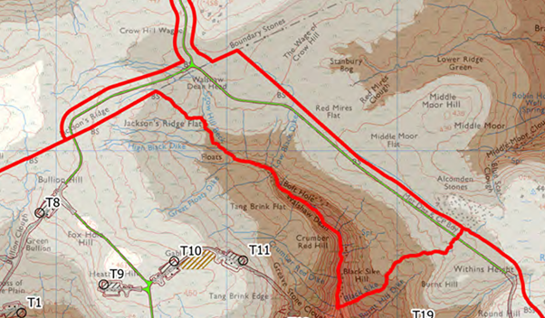
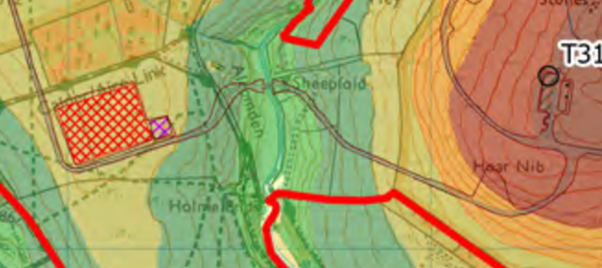
When we last analysed the southern crossing, we assumed the CEP bridge would be next to the existing bridges at Holme Ends; and that the line of the tarmac track to Walshaw Lodge would be used, which slides down the steep valley side at 9%. It is impossible for our analyses to be as destructive as what emerges because nobody would believe them if they were (“Scaremongering!”) For example, we could not predict the northern entrance to CEP because it requires Algihaz to spend millions of pounds on a private bypass of the Lancashire Moor Road, and the ascent of Crow Hill, scene of eight major mass movements of peat between 1824 and 1989. We could not predict the Stanbury Bog Expressway because it was outside the site’s red line from September 2023 until April 2026; it opens up the least disturbed habitat in the South Pennines Special Protection Area like a logging road in the rain forest, and will be popular among despoilers on quadbikes with disposable barbecues. We do not yet know Natural England’s attitude to this unconsulted expansion of the red line boundary, four consultations deep into the process.
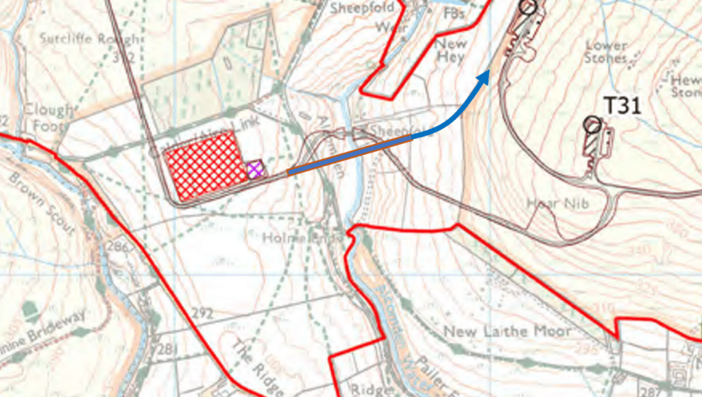
The CWF Ltd coloured map is a pretty thing, but handsome is as handsome does, and we need to read the contours and see what an 80-metre blade delivery looks like on a legible base map.
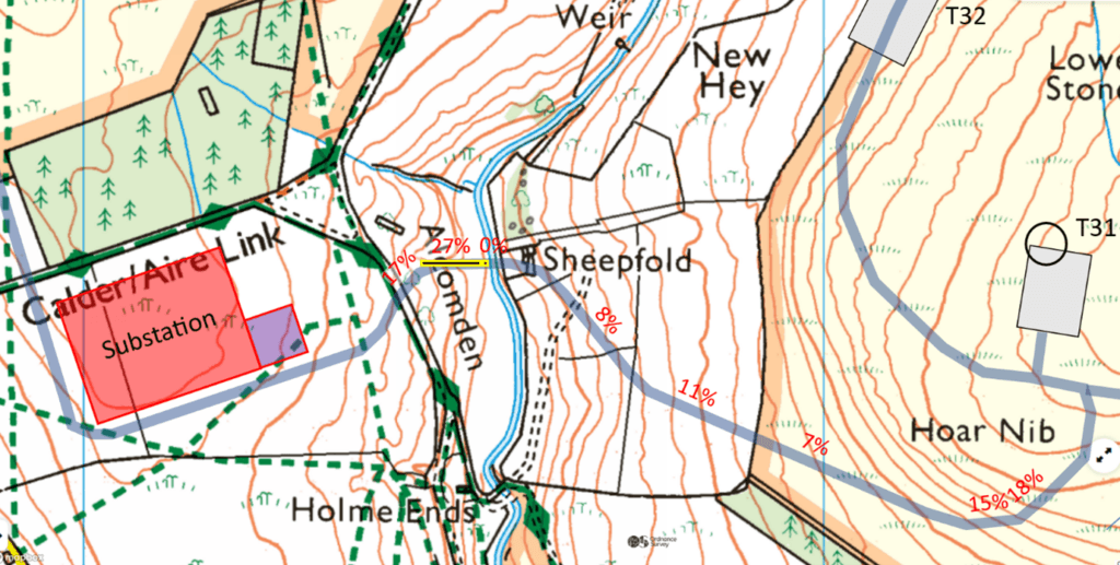
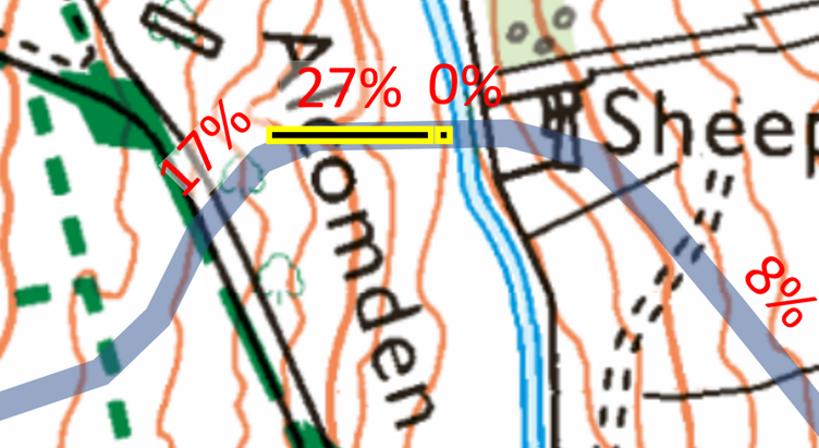
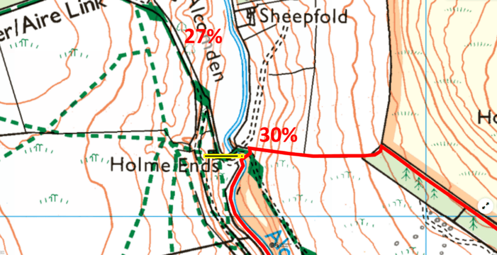
The crux of the crossing is the 27% drop down to the new bridge. The issue is partly the steepness, which is excessive: 10% is a working maximum; higher gradients might be justified with the manufacturers and insurers; 27% is miles out of line. Just as serious is the change in gradient within a blade length from 27% to 0% on the bridge. This is well beyond the normal envelope of a blade delivery and would cause the vertical equivalent of a jack-knife in the swivel between lorry and trailer. It also applies an unusual horizontal force to the bridge, which is designed for vertical forces. There are special solutions that might be used on a spur, but this is a spine track carrying half the materials for CEP. Although the blades are the most awkward components, the nacelles are much the heaviest, and stripped down are still 70-80 tonnes for transport. With the lorry and trailer, this gives a gross weight of over 100 tonnes and the 27% downslope is much too steep for this weight. Alcomden Bridge as drawn is not a turbine component delivery route.
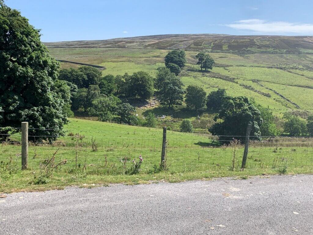
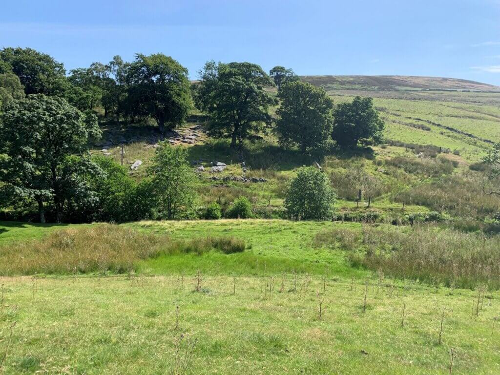
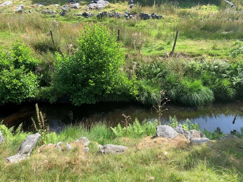
This crossing is no place for the embanked culverts that CWF Ltd are hoping to be permitted elsewhere. In such places the Environment Agency requires a bridge without parapets that a flood can pass over, and that is what is shown in the maps. The 27% track down will focus high-speed rain runoff on the south bridge abutment and undermine it unless complex drainage is installed. The abutments as drawn will nip-in the flood water and accelerate it.
Like Donald Mackay, I can get neither my heavy, nor my awkward, components across Alcomden Water, so I turn downstream to the Holme Ends bridges. I know the grazing is strongly fenced at the moor edge, so I leave the turbine area and walk up a rough track towards the strip of Leylandii that shelters pheasants on the residual Savile Estate; beyond the sad trees I can step over a tiny fence back onto Richard Bannister’s moor. Then I walk back to where the CEP track will leave the valley grazing.
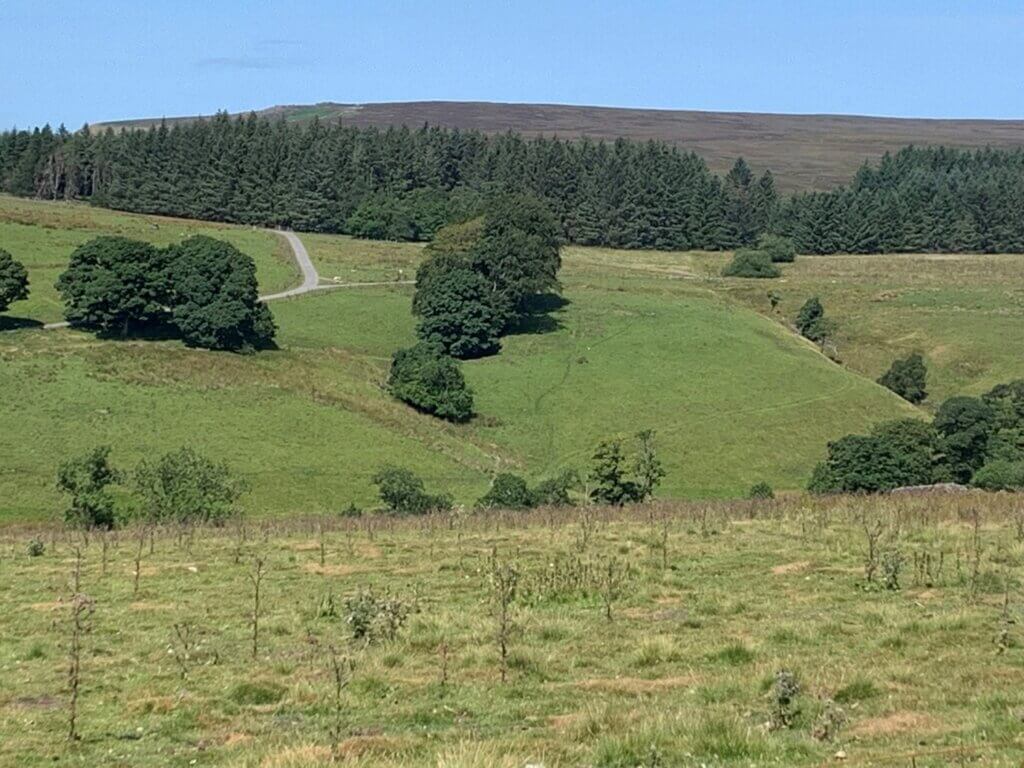
I am certain the three-dimensional geometry of the proposed crossing will not work for ordinary braked lorry deliveries of 80-metre blades or 100-tonne nacelles. There are always other things that can be done with winches and concrete, but the reason for the Stanbury Bog Expressway is clear. Donald Mackay reckons he won’t get massive turbine components across Alcomden Water. But Natural England should strongly oppose the Stanbury Bog Expressway which has been sprung on them by Algihaz at absurdly late notice.
How is it that Algihaz have reached this position after almost five years of study, since their inadequate due diligence in November 2021?
Algihaz need a crossing here because the buried export cable leaves the substation and follows the track system to the A6033 at the elephant on Cock Hill. This cable, whose duct will be drilled under Alcomden Water, needs a haul track alongside. This does not have to be to the standard of a turbine delivery track, but it does have to support HGV cable delivery, diggers and a hauling rig, and of course HGVs are used to build it. The bare minimum for safety on the 27% section would be ribbed concrete, but this would not solve the nacelle and blade geometry problems. Similarly, the 66 kV onsite cabling (‘collection strings’ with the turbines like fairy lights wired in series) must come back to the substation from the turbines east of Walshaw Dean along the line of the haul track. So, there has to be an Alcomden Water bridge.
The Stanbury Bog Expressway should be unacceptable to Natural England and the Environment Agency, especially as it comes out of the blue. Donald Mackay has to give Algihaz a second crossing for turbine components, but as drawn the bridge will not work. Why does he not use the existing crossing point for a third bridge?
The existing bridges are in the tight squeeze of the valley sides and the site red line. A planning obstacle is that the stone Holme Ends bridge and the farmhouse are Grade II listed buildings, but it is the geometry and red line that defeats the existing crossing point.
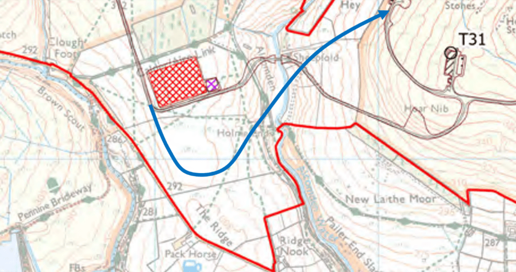
To stay inside the red line and use the existing track lines either side of the bridge requires far too tight a bend. The geometrically correct solution is to cross slightly north of Holme Ends and carry on beyond the red line on New Laithe Moor. The moor above is defended by a very steep edge, so the green traverse line below would have to continue across Jack Allotment. The alternative blue hairpin could be executed on New Laithe Moor, though this ground is steep for the engineering of the turn and may need concrete buttressing. The main problem is that it belongs to the Savile Estate.
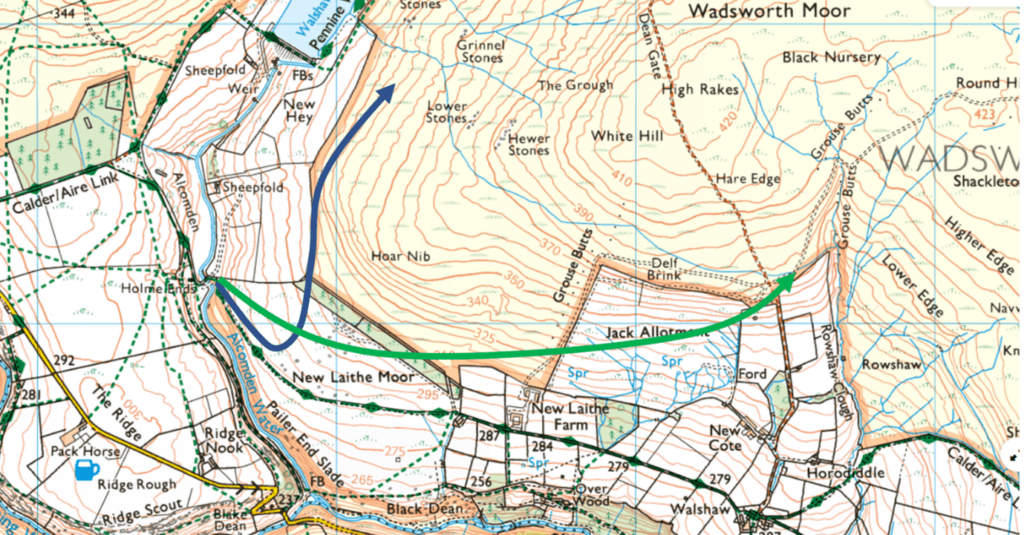
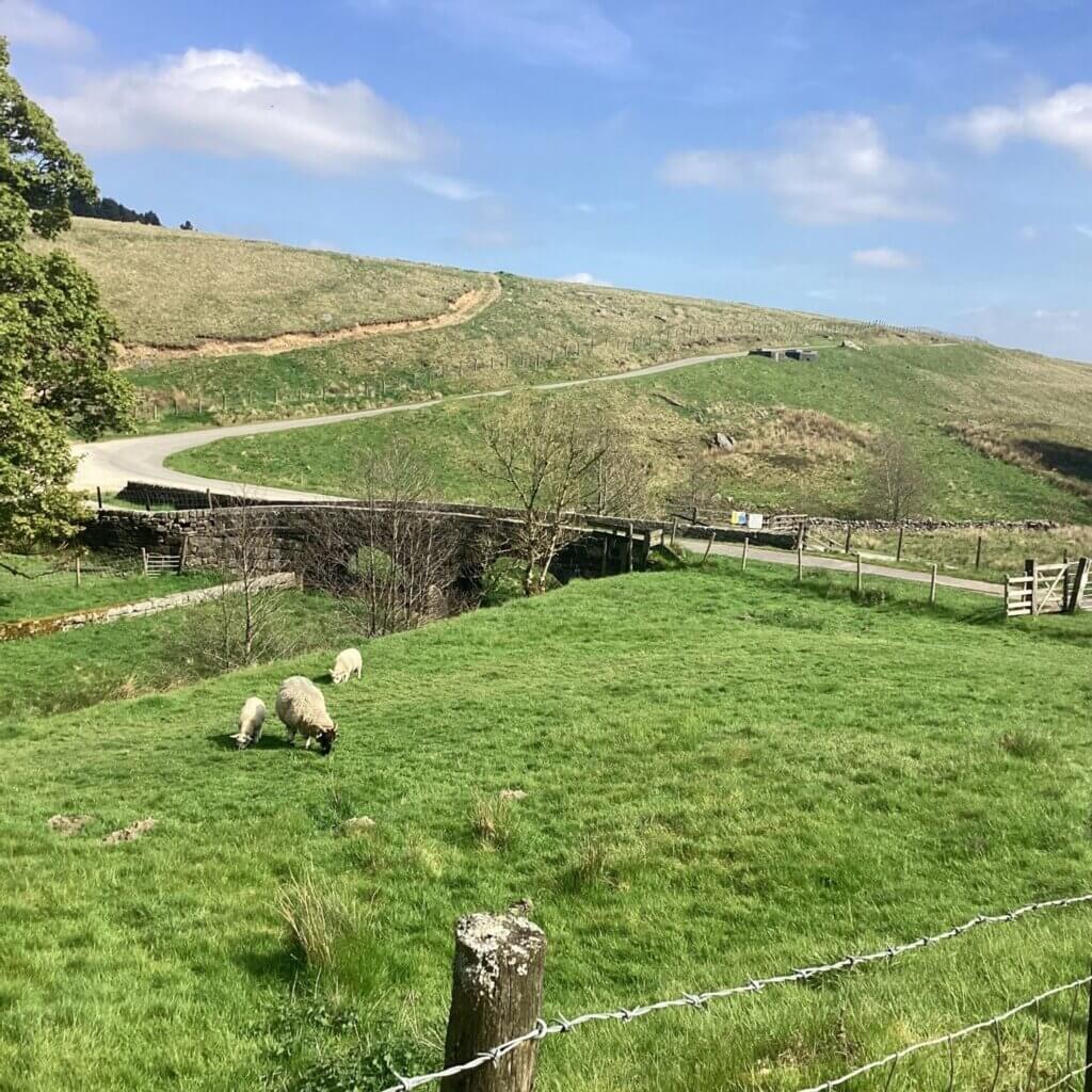
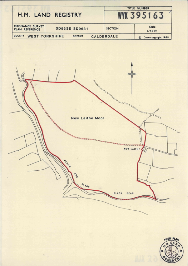
CWF Ltd must be very reluctant to negotiate with the Savile Estate if they prefer a 27% drop to the New Laithe hairpin. The comparison between the grasping and destructive behaviour of Algihaz and Richard Bannister and that of the beloved 3rd Baron Savile, who gave Hardcastle Crags to the National Trust to save it from being flooded for a reservoir, may be too excruciating. The Savile Estate would not willingly agree to sell New Laithe Moor because CEP hugely impairs the amenity of their land. The title registry has no indication that Algihaz have an option on New Laithe Moor as they do on Walshaw Moor.
The DCO submission for CEP will not be permitted to invoke the possibility that New Laithe Moor can be purchased subsequently to get the access track back up to Walshaw Moor from the crossing.
With New Laithe Moor sealed off for present purposes, we should see if a full Alcomden Water crossing can be made within the red line. The material changes involved in the two possibilities may require further statutory consultation.
A skew crossing is always much harder to engineer than a perpendicular crossing. Many readers will be thinking about the famous alternative model: Enoch Tempest’s trestle bridge for the Blake Dean Railway which crossed Graining Water about 1200 metres further south and was built to serve reservoir construction.
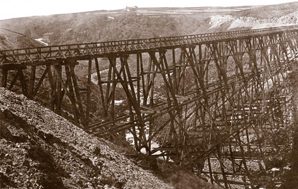
The idea is not to descend to the valley floor but build a structure that crosses at the level of the substation.
Although this discussion is eventually relevant to the examination of the DCO submission for CEP, the immediate market for the information that the PIER account of the Alcomden Water crossing is not suitable for blade or nacelle delivery is Mustapha Hajjar the CEO of Algihaz Holding. The weak point is always the money, and the patience of Mustapha Hajjar is famous but finite. His minions at CWF Ltd have failed to supply “best in class expertise”, “trusted relationships” or “robust capability” and they make a mockery of his mission statement.

Algihaz themselves didn’t have enough “passion and dedication” to discover that the onside rock won’t work at due diligence. Mustapha Hajjar may “drive innovation across a range of sectors”, but can he drive a 100-tonne nacelle delivery down a 27% track?
The smoking gun is the late extension of the red line over Stanbury Bog. This is an admission that between due diligence concluding 11 November 2021 and the PEIR on 8 April 2026, Algihaz thought they could get turbine components over Alcomden Water simply, and they published two layouts (65-turbine CWF and 41-turbine CEP) where that was the engineering assumption. Algihaz have now shown the Planning Inspectorate that they no longer believe the crossing will be simple, by publishing a highly controversial alternative on Stanbury Bog. Mustapha Hajjar is surely up-to-speed with all this, but if not, then he is now.
Readers may think that in Saudi Arabia all this would be driven through by Crown Prince Mohammed bin Salman Al Saud, but he has far more love for wildlife than Christian Egal and Christopher ‘440 Kelvin Volts’ Wilson. In Saudi Arabia they respect the Kunming-Montreal Global Biodiversity Framework and its 30 by 30 target.
Do Andy Burnham and Miatta Fahnbulleh?
With this interesting discovery in the bag, I head up to the nondescript site of T31 Hoar Nib. The 18% gradient on the curve up is less relevant if the turbine components are not coming this way, but it is still very steep for any HGV on an aggregate track and this should be graded out by the DCO. The present alignment understandably prefers a right-angle junction with the ring track serving the Wadsworth Cluster so that the HGVs can turn both ways; the cost is an 18% pull up the aggregate on the corner. The unusual bulge in the track envelope has not been explained; unusual drainage work will be essential near this feature because of the vulnerability to washout of the 18% corner.
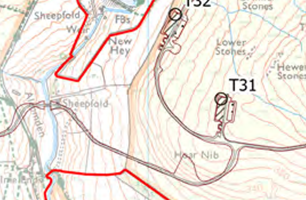
There are still a lot of skylarks and meadow pipits about. The soil is fissured and dusty and I don’t bother to probe the peat because, unlike Stanbury Bog, there isn’t much.
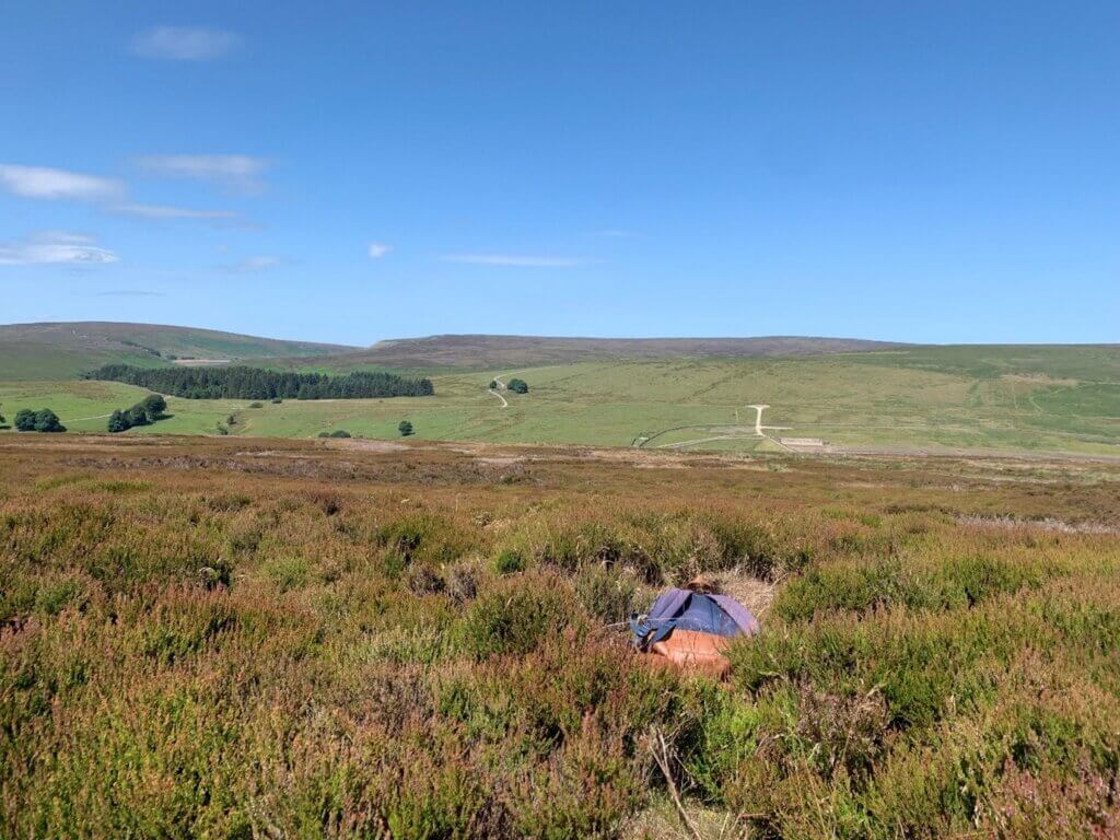
I drop down towards the dam to make my own recrossing of Walshaw Dean. The tussocks between T32 Deer Stones and the reservoir have high grass now and give the grimmest walking on the moor, so I try to work sideways on the heather to the end of New Hey, where I have spotted some steps set in the Yorkshire Water wall. I tumble three times in reaching the steps, letting the tussocks cushion my fall. Sitting on top of the wall I find there are no steps down on the other side, and the slabs of the Pennine Way are tantalisingly eight feet below me. There is no handhold for a hang drop because the coping is wide, smooth and semi-circular. Thirty years ago I might have jumped. Instead, I buttock creep sideways for five minutes to a corner where friction on splayed boot soles lets me slide down the immaculate wall with some dignity. The onsite gritstone is useless as aggregate but brilliant for drystone walling, and this wall is tighter than Machu Picchu (twinned with Fukushima, Petra and … Haworth.)
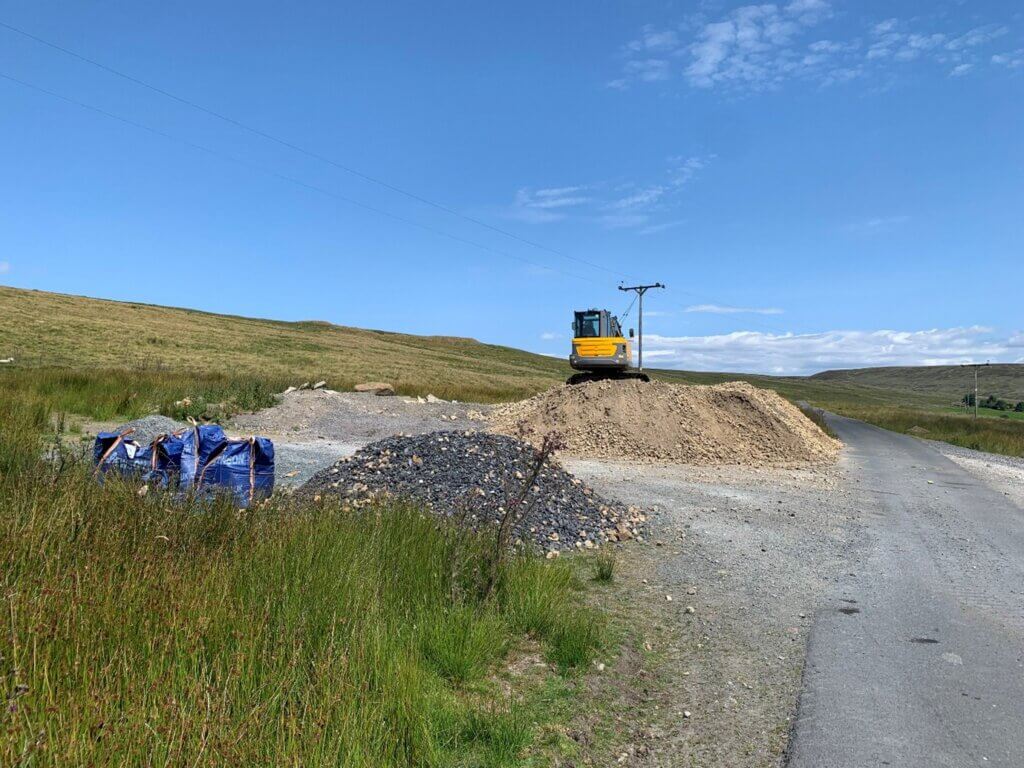
Across their dam, Yorkshire Water complete their geology lesson for Mustapha Hajjar. His minions should have found all this out before Algihaz signed their agreement with the Walshaw Moor Estate on 11 November 2021, and all Mustapha Hajjar’s lawyers needed to do was ask Richard Bannister how he built his tracks.
++++++++++++++++++++++++++++++++++++++++++++++++
This is the 60th in a series of guest blogs originally based on the 65 wind turbines which Richard Bannister planned to have erected on Walshaw Moor.
The developers canned their original 65 wind turbines, quite possibly in response to the public humiliation of having their so-called ‘plan’ publicly shown to be damaging, irrational and probably unlawful. They came back with a plan for 42 wind turbines and the amazing Nick MacKinnon and friends ridiculed that so-called plan. Now the developers have brought forward a 34-turbine revision – the series continues.
To see all the blogs – click here.
[registration_form]