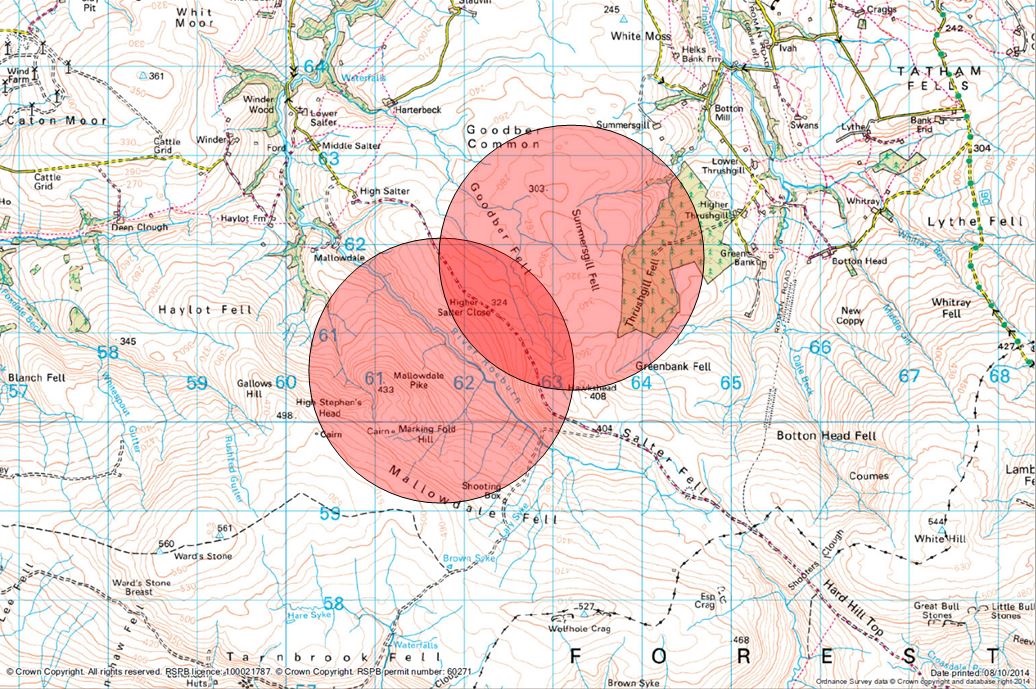
The RSPB Skydancer project released this map yesterday showing the last known locations of the missing Hen Harriers, Sky and Hope.
A quick look at Google maps, entering ‘Forest of Bowland’ and looking at the northern area, north of Wolfhole Crag, will get you to the right area. Switch from ‘map’ to ‘satellite image’ and you’ll see the characteristic burning pattern of heather between Wolfhole Crag and the River Roeburn.
Then go to MAGIC and find the Bowland Fells SSSI and you’ll see that these two birds were last recorded in or near that SSSI. The records from NE show that quite a lot of this SSSI is in unfavourable condition – much of it not recovering (which is something of a rarity these days) and that the reason it is considered to be in unfavourable condition and declining is given as being due to the decline in the Lesser Black-backed Gull colony where NE found evidence (in 2012) of widespread culling and disturbance.
Much of the area in the bottom half of the map above is a Special Protection Area for birds, designated under the EU Birds Directive – these birds may not have been specially protected enough.
If you have any information about these birds then please contact Crimestoppers on 0800 555 111 or the RSPB’s confidential hotline on 0845 466 3636
[registration_form]

Should be possible to tie these areas down to a gamekeeper or three shouldn’t it?
Good for RSPB in releasing this information. Certainly helps us to develop an understanding of the crime scene.
I wonder what the landowners take on this is? It’s a rather depressing part of Bowland (although nowhere is great) for raptors and not exactly full of foxes so can dispel that lame myth. The lower slopes of this area are also a red legged partridge factory. Interesting how they both disappeared in a similar area.
Yes, go on, who owns the estate, how much subsidy do they get, and who are the gamekeepers? And, if there can be foraging cams on seabirds we should have death cams on harriers for a last pic of the person who comes to dispose of the body.