Christopher Goddard is a cartographer and writer whose hand-drawn guidebooks and maps cover the West Yorkshire landscape in intimate detail. Born in Sheffield, he has lived in Hebden Bridge for nearly 20 years and explored most corners of the area’s moors and woods. There is more information at christophergoddard.net .
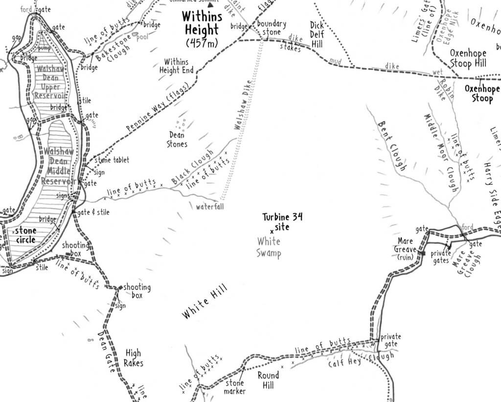
Turbine 34: White Swamp SD 98144 33521, what3words ///wealth.rapid.motor
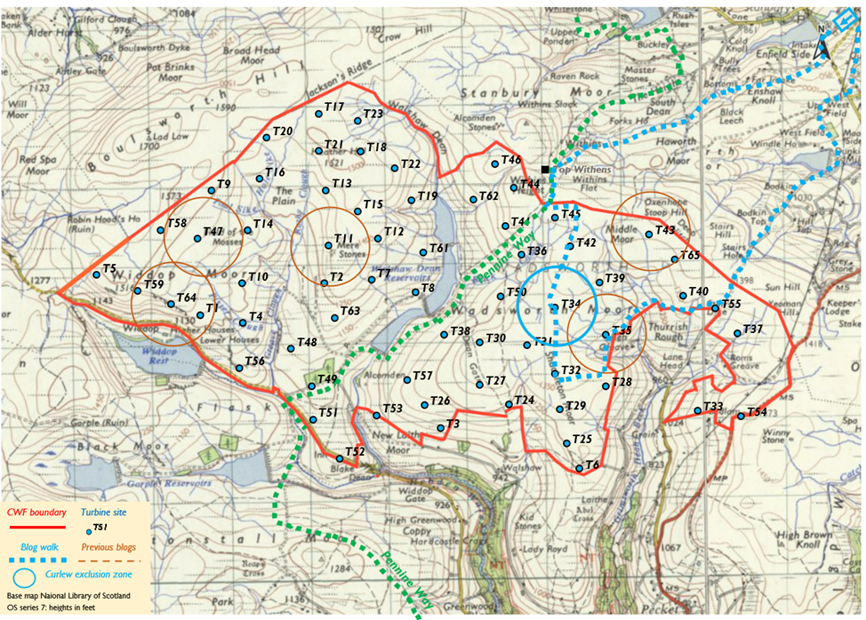
Writing a blog about one of the proposed sites of the turbines on the Calderdale Wind Farm is right up my street, an excuse to explore and a chance to gather my thoughts about the proposed wind farm. I have chosen to focus on Turbine 34, one of the most remote turbine sites, a long way from any paths and located on featureless ground between Walshaw Dean and the head of Crimsworth Dean. It lies on White Swamp, an area I never ventured all the way across while mapping the West Yorkshire Moors. Back then, I wrote that it was ‘A truly barren stretch of moor… If you are brave enough to cross, the high ground can be followed…’ I was keen to explore more of the blank spaces on my map, so I set off in running gear from the edge of Haworth on a suitably wintery day.
Heading up past Lower Laithe Reservoir and the Brontë Seat, freezing slushy snow begins to fall across my face. Snow thickens on the ground as I climb up to Top Withens, passing the last walkers I will see as they huddle against its walls. The Pennine Way slabs are hard to make out as I pick my way up to the ridgeline, along which I know a path runs towards Dick Delf Hill. Today it is hard going, squelchy mud beneath squelchy snow, so I branch off the path at the first boundary stone (the site of Turbine 45).
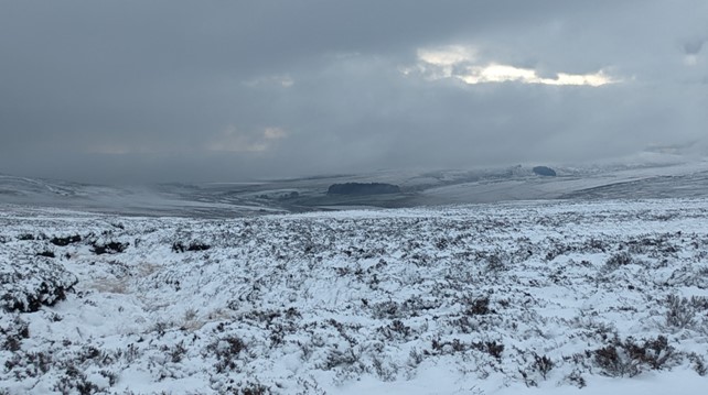
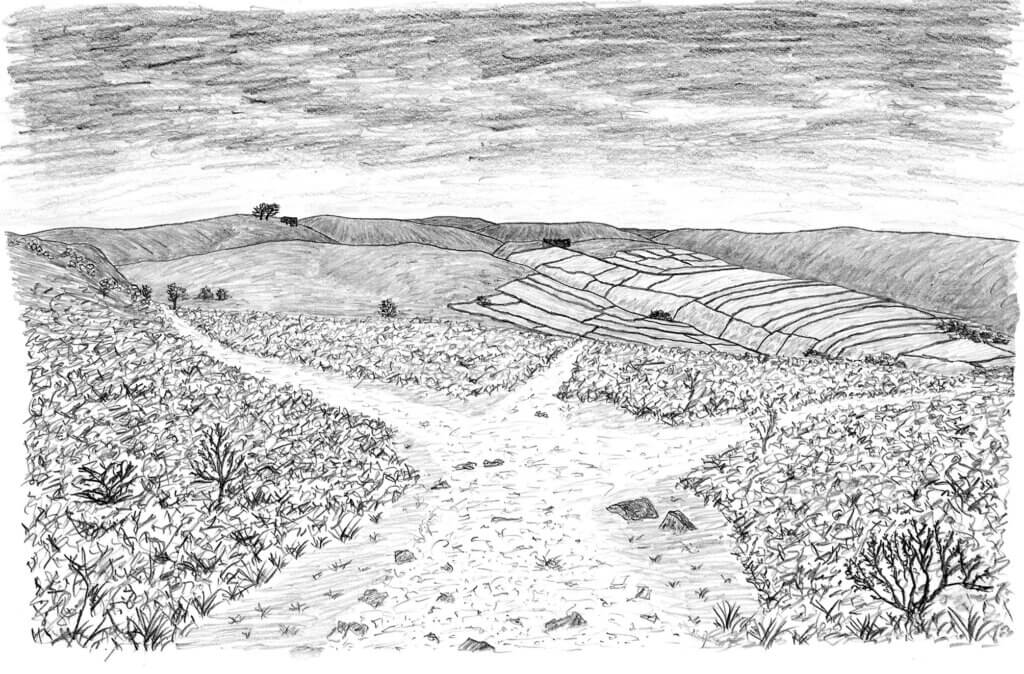
It is a mile almost due south to the site of Turbine 34 across deep heather and myriad groughs cut in the peat. The snow has stopped and there is a brightness in the distant sky beyond the Walshaw Reservoirs. I’m too busy looking at this iridescent view and promptly fall flat on my face, soaking myself to the bone in wet freezing snow.
I aim for the end of a shallow spur that descends off Dick Delf Hill, passing the site of Turbine 42 before eventually finding myself looking down on a flat lonely shoulder of moor that I know to be White Swamp – a place I’ve marked on my maps, but never crossed, intimidated by the distance to reach it and the name itself.
Somewhere on this 400-metre wide expanse of flatness is the proposed site of Turbine 34. I take out my phone to navigate to it by GPS – not something I like relying on but the only way to get to the exact spot. The phone too is soaked, and my freezing fingers struggle to swipe the screen, but it soon confirms the pin is only a short distance away.
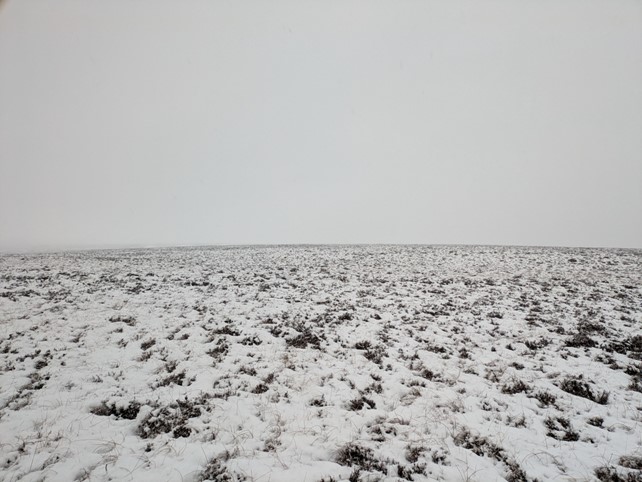
I drop down off the shoulder and after about 100 metres I reach the pin. Of course there’s nothing here – I don’t know why I expected otherwise. It is an apparently unremarkable patch of heather between a pair of long grips that have previously been dug across White Swamp by the Walshaw Estate to help drain wet areas of moor like this and promote heather growth and therefore grouse numbers.
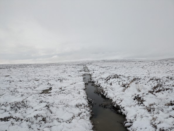
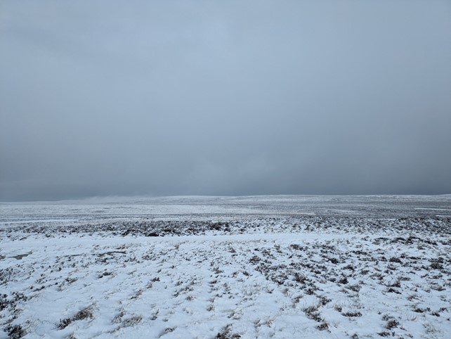
As I head away from the site, the drains here become more striking and numerous, and this apparently natural landscape is exposed as the intensively farmed monoculture it has become. It’s hard to tell if there is any sphagnum beneath the snow on the ground, but there are plenty of grouse. There is mercifully little wind today, so the only sound is their awkward crawing from the heather waste around me. As the sky brightens in the distance, I realise I can see Stoodley Pike away in the distance to the south, as well as Boulsworth Hill and Widdop closer to hand. It is a view of these hills I’ve not seen before, and it takes a moment to get the faint snowy outlines in perspective. I try to imagine a 200-metre-high turbine where I’m standing, but any sense of perspective is hard to come by here. All I can picture is a great column of metal leading inexorably up into the cloud and the slow swoosh of the blades drowning out the birdsong.
Soaked to the skin, I’m growing cold and continue my exploration south across the swamp. I aim for the prominent rise of Round Hill (the site of Turbine 32), passing dozens of grips and grouse feeders on the way past White Hill, then following a snowy quad track through the grassy tussocks. The estate’s hands have gone to a lot of trouble to breed and feed these grouse – imagine what else could be achieved up here with this amount of labour.
Eventually I reach the vehicle track I’ve nicknamed the Hunters’ Highway and look back from Round Hill towards White Swamp, over half a mile away. It’s hard to make out the flat expanse from here, simply another part of the snowy wastes stretching away to the ridgeline. Even landscapes as apparently featureless as White Swamp change every time you turn around and look.
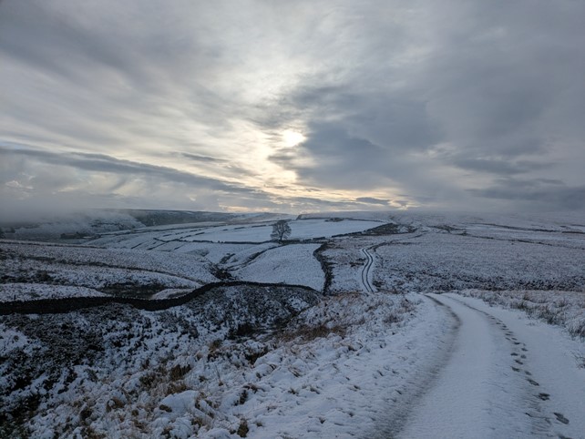
The Hunters Highway leads around the south side of the moor, passing Calf Hey Clough, crossing Mare Greave Clough and climbing to join Stairs Lane. This vehicle track is a controversial imposition on a moor that was almost impassable when I first explored it, its creation another chapter in the moor’s chequered management, but it is very handy on a day like this, a rollercoaster ride with great views down Crimsworth Dean. I listen to curlews, who have started to arrive on the lower fringes of the moor to herald the imminent arrival of spring, even though it doesn’t feel particularly close today. I head back over Top of Stairs and stay on the main paths to Haworth, having had enough of the cold slushy ground for one afternoon. By the time I return over Penistone Hill, most of the snow on the lower moors has already melted away and Haworth lies in a green bowl, its colour far from the white swamp I’d ventured into.
I wanted to do this blog to collect my own thoughts on the proposed Calderdale Wind Farm, but I didn’t want to simply restate all of the very good arguments about the folly of building vast turbines on internationally significant areas of blanket bog, which have been well made by people who know far more about it than me. Wind turbines are a tricky topic for many of us at the greener end of politics as instinctively we should support them. I’ve found myself marvelling at them when surveying parts of mid Wales, enjoying their company on the Pegwn hills where otherwise there are only forestry plantations and impassable footpaths. I’ve navigated by them in the miles of plantations that cover the hills of Dumfries and Galloway and been glad of their reassuring swoosh as I pass in thick cloud. But then turbines were constructed on Crook Hill and Reaps Moss above Todmorden, moors I’d mapped forensically when there was nothing but grass and sheep tracks up there. Suddenly, I resented the fact that a lonely boundary stone lost in the bog that formed one of the few markers between Noon Hill and Crook Hill was towered over by a nearby turbine and that the world represented by my map was lost forever. Had I become a NIMBY – put it on someone else’s moor but not mine?
A couple of weeks ago I found myself back on Crook Hill when snow last lay thick on the ground. This time the ground was covered with dry powder snow under a perfect blue sky, and I yomped joyfully round the wind farm area with Greater Manchester laid out below. It was hard not to think that the brilliant white flashing off the turbine blades didn’t complement that of the snow rather well. I did wonder if it was possible to learn to live with and even embrace impositions like these.
Which brings us back to the Calderdale Wind Farm. It is hard not to think that Mr Bannister is trolling us by making the hippies of Hebden Bridge come out and protest against apparently green energy. For a number of years I had wondered why large companies and those with money were so apparently opposed to green technology, instead of investing in and profiting from it since it was such an obvious cash cow. I’d even said on occasion that I’d take this capitalistic profiteering at this point, as at least it would help mitigate the effects of climate change. As usual I’d underestimated those forces’ ability to turn anything into a shitshow, and not appreciated quite what greenwashing looks like. Now I know it looks like 2,352 hectares of unique moorland habitat being turned into an industrial landscape, simply for profit, with nothing approaching any environmental benefit. I’m annoyed, but also utterly deflated by this, and it takes me going for a run into the heart of this wilderness to bring it home. This part of the industrial north of England has few empty spaces left (indeed perhaps only Bleaklow and Boulsworth qualify), few places where its ten million inhabitants can go and feel alone and in awe of the world for a few hours. If you’re going to take one of these away from us, you need to have a better reason than money. Please don’t fill in the map until there’s nothing left.
This is the 6th in a series of 65 guest blogs on each of the wind turbines which Richard Bannister plans to have erected on Walshaw Moor. Turbines 11, 35, 43, 47 and 64 have already been described. To see all the blogs – click here.
[registration_form]
Brilliant. These are so good. Thanks to all involved.