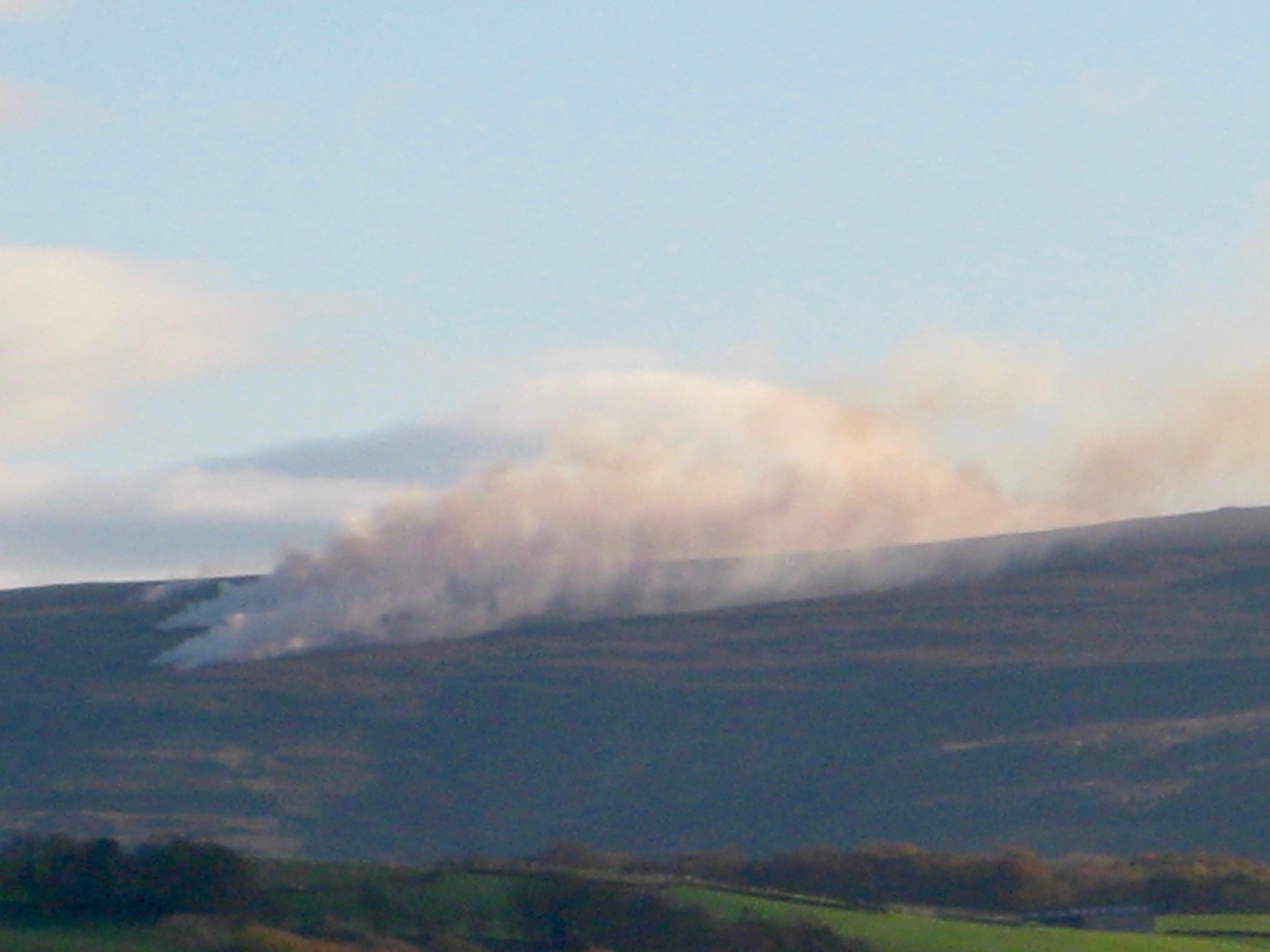
This image, from a walker, shows moorland burning a few days ago on Forest of Bowland grouse moors.
This burn was on the slopes of Conder Head.
Now, the Duke of Westminster’s Abbeystead Estate has signed up to the voluntary agreement not to burn blanket bog – so was this a transgression?
According to this map from the DEFRA MAGIC system, it wasn’t, as it was outside the buff area of blanket bog.
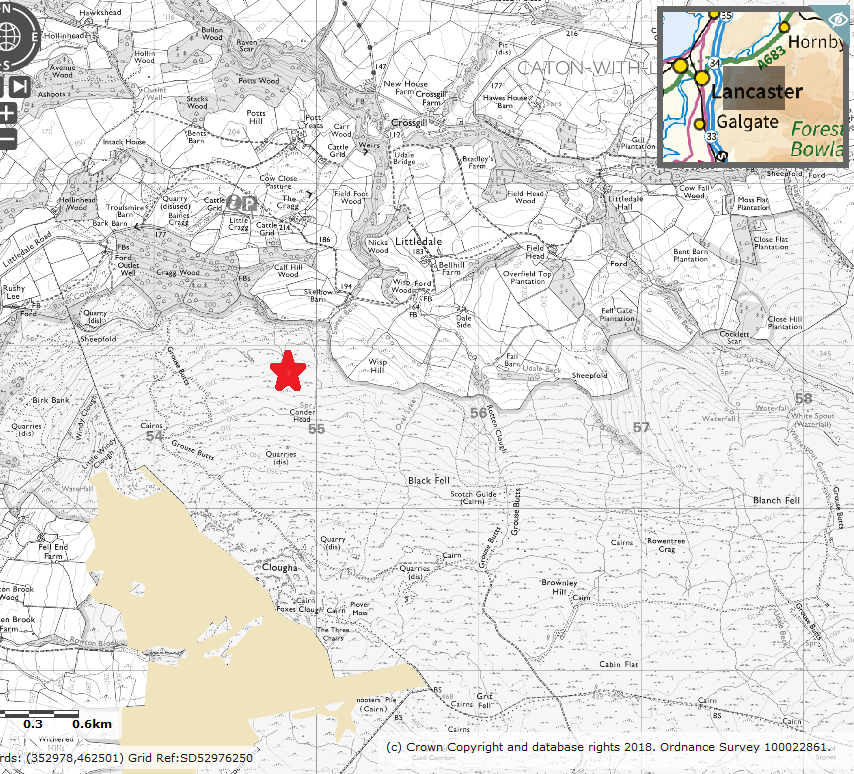
That buff boundary of the blanket bog looks a bit suspect to me, but that’s what the map shows so this appears to be a case of legitimate moorland burning which is not on blanket bog.
But I do wonder what would happen if one went and measured the peat depth on the slopes of Conder Fell, some time…
I hope someone is prepared to go and measure the peat depth on Condor Fell, recording depth and location for each of the measurements.
If the burning has to be in line with the code, don’t overlook the other situations where it should not happen….very thin soils for instance….
It would be interesting indeed although most of the area not marked as blanket bog on Conder Head and Clougha have very thin peat or acid soil with a great deal of broken rock ( think its called “Glabra”) much of the surface is in fact broken rock. There are however pockets of deeper peat.