 In their little booklet, the GWCT address five areas that they say are commonly-heard criticisms of driven grouse shooting. This week I’ll deal with each of them.
GWCT say that a commonly-heard criticism is that ‘Heather burning on grouse moors increases flooding’ and attempt to sidestep this in the same way that they attempted to swerve the evidence for peat degradation and carbon emissions; by quoting an old (2013) study and ignoring the evidence that has come along since!
The same NE study used for support by GWCT on peat damage says ‘…no evidence was identified specifically relating to the effect of burning on watercourse flow or the risk of downstream flood events. If there are any effects, they are likely to be highly site specific.’ although of course if your site, say Hebden Bridge, is affected then the fact that your flood is, rather like every flood, site-specific won’t be much consolation to you. But GWCT omitted to quote the preceding words ‘There is weak evidence from small-scale plot/stand studies: of shallower water tables initially after burning; and of increased frequency of surface runoff after recent burning‘ and although weak evidence is not as good as strong evidence it cannot be dismissed as no evidence – but GWCT chose to ignore it. GWCT also chose to ignore that the NE report specifically referred to the ‘nearly completed EMBER report’ as tackling these questions (p57, section 12.36).
The EMBER study is quite cautious about whether they found evidence that burning increased peak water flows but there is some subsequent analysis by the same team which you can read. It’s not an easy read for the layman but if you go to Fig 6 it is clear that the impacts of burning are to remove vegetation, reduce the water table and therefore reduce the colonisation of mosses and to lead to compaction of the soil – all of which, when it rains very heavily, lead to higher peaks of water (aka floods).
That’s why the paper states ‘For the largest 20% of storms, the hydrograph intensity of burnt catchments was significantly greater than those of unburnt catchments (means of 4.2 × 10⁻⁵ and 3.4 × 10⁻⁵ s−1, respectively), thereby indicating a nonlinear streamflow response to prescribed burning.’. GWCT regard this as inconclusive but then judged by their treatment of Hen Harrier evidence they will regard anything inconvenient, or indeed utterly damning, as inconclusive. I guess they don’t have any option really.
But it isn’t just burning heather that the critics of driven grouse shooting say increases flood risk – it’s the whole management package including maintaining and putting in drainage channels. GWCT try to make out that all this drainage is historic and was all the fault of government policy. To some extent it was, but drainage channels have been maintained on grouse moors for decades because grouse managers believe, with some justification, that drainage and burning together will encourage heather growth.
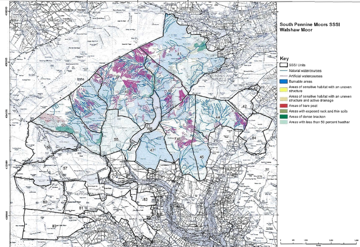
One site under specific spotlight on this issue is the Calder Valley and communities such as Hebden Bridge which have flooded more seriously and more frequently in recent years. The community there believe that the management of the grouse moors above their town, one of which is Walshaw Moor, has led to worsening floods. As well as all that heather burning let us remember that the case that NE took against Walshaw Moor in 2012 (but which was mysteriously dropped) included 45 charges of which 30 were of illegal moor gripping (ie drainage channels)(see Inglorious pp149-57, 175-76, 190-92).
Here’s a map of Walshaw Moor which shows the artificial drainage channels.
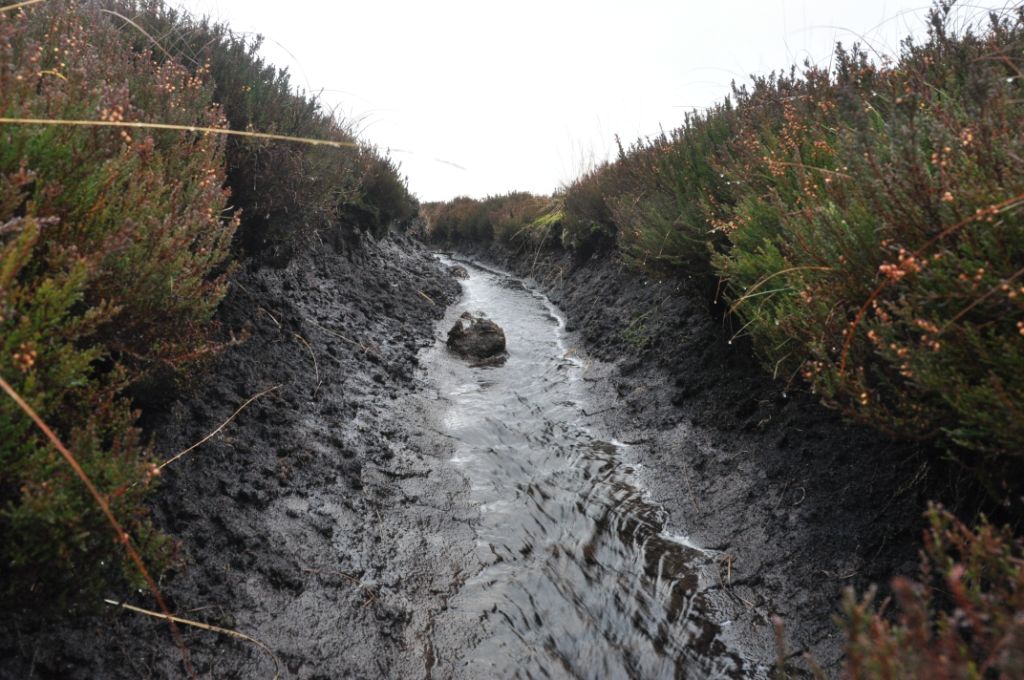
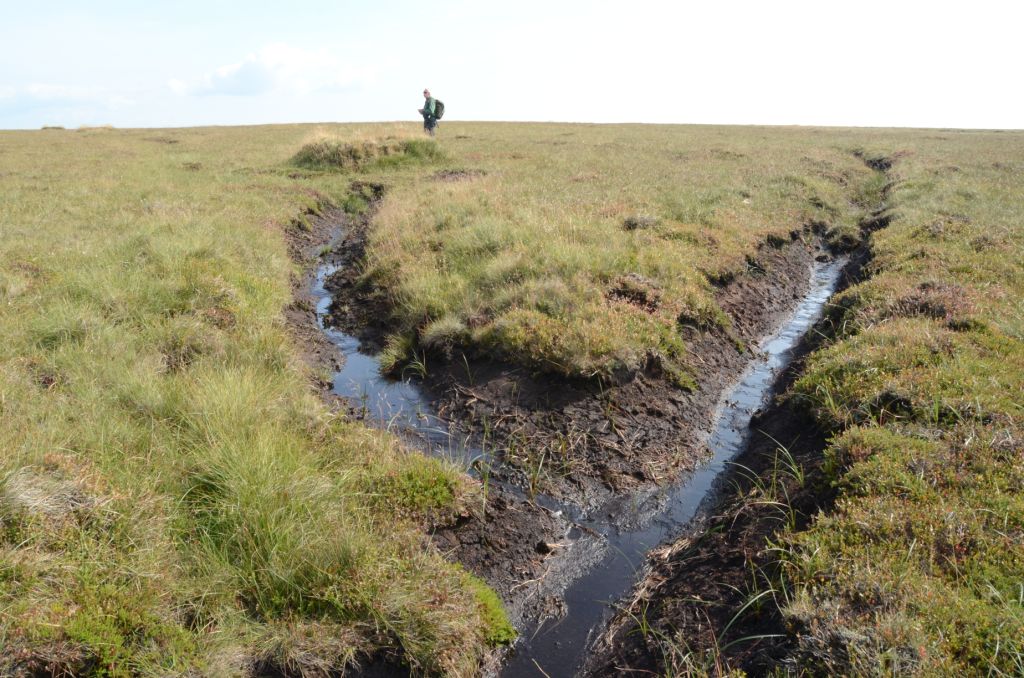
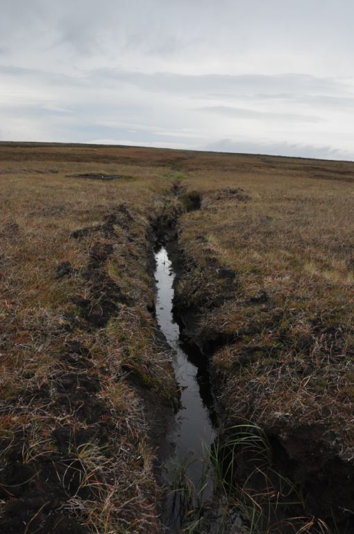
And here is what one looks like:
A specific modelling study has been done for the Hebden Bridge area which seems to suggest (though I don’t know much about it) that flood risk has increased due to changes in upland management above the town.
Here’s an example of what local people think of the grouse moors above their towns, moorland owners are not entitled to manage estates ‘in a way that threatens the lives, livelihoods and properties of people further down the valleys.’.
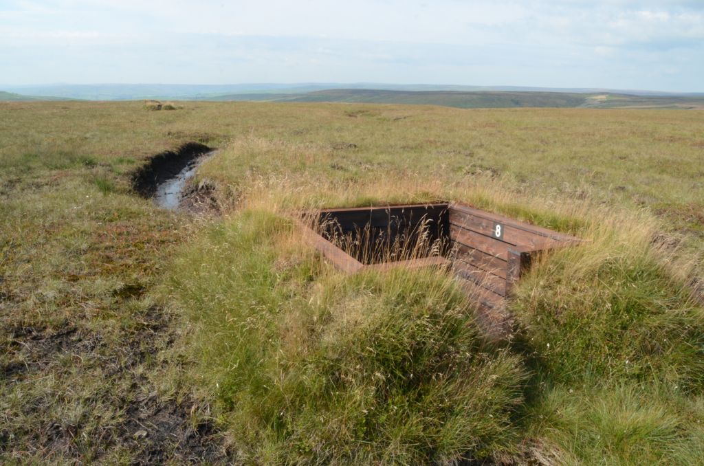
And here are some other photos of wetlands on Walshaw Moor:
The GWCT booklet won’t admit that recent moorland drainage is a problem for flood risk. However, their upland members and land managers who are also members of the Moorland Association are very keen to be paid for restoring peatlands in order to reduce flood risk.
As an example, the Fitzwilliam Wentworth Estate (which might interest some of the gamekeepers who were present at my talk in Chesterfield last week) ‘has been entered into a Higher Level Stewardship Scheme. This will see the implementation of a major project for re-wetting large areas damaged by centuries of acid rain, helping alleviate flood risk, revitalise carbon sequestering plants and protect against wildfire‘.
On Exmoor, a collaborative project away from grouse moors, has made excellent progress with restoring blanket bogs, reducing run-off and reducing water discolouration.
It seems to me that the science that we have, suggests very strongly that when there is a lot of rain on land where there has been a lot of burning and where there are a lot of drainage channels then floods are much more likely. And floods like those that have hit several communities in the Calder Valley have economic costs of millions, possibly tens of millions of pounds and that doesn’t take into account the human emotional costs.
It’s quite fitting to end this little round up of the GWCT’s booklet at Walshaw Moor because it is still a case that is under investigation by the European Commission following the RSPB’s complaint to Europe in October 2012. I gather that NE are struggling to agree a moorland management plan at Walshaw Moor and so will struggle to show the EU that they have got a grip of things.
Walshaw Moor is just one of 132 cases of burning on deep peats that the RSPB has bundled together and they stated back in 2014 that it’s not clear ‘whether Walshaw Moor represents a particularly intensive example or whether it is typical‘ and ‘Despite the presumption against burning in the government’s own Code of Practice, it appears to have become the norm on grouse moors in England‘.
We’ll see from the moorland management plans that are being produced what the current state of play is but GWCT will find it difficult to deny that heather burning and drainage of grouse moors increases flood risk at sites like the Calder Valley.
[registration_form]
It seems bizarre in taxpayer VFM terms that landowners can dig moorland drainage channels, then claim substantial subsidies for subsequently blocking them. Let’s hope that SoS Mr Gove will stick to the word of his recend speech in reforming the subsidy regime in favour of showing benefit to the taxpayer, rather than paying very rich and influential people, mainly just for owning a lot of land.
The science should inform this debate, and not just cherry picked pieces of the science. A study from a couple of years ago (Odoni/Milledge) showed that a specific simple and ridiculously cheap design of gully block ‘the letterbox design’ can slow the flow by allowing drainage, but at a slower rate, giving a compromise between effective drainage and no longer speeding the flow to create flooding downstream. These blocks also provide efficient sediment traps which will improve water quality and reduce sedimentation which later required dredging from rivers. Add in the drought reduction benefits from retaining water for longer on moorland and you would think that everyone would jump at the opportunity. Perhaps some ‘unentrenching’ is needed.
Mike – it may sound bizarre but after the war moorland mangers were paid to dig ditches to improve the grazing for sheep and deer (not grouse) – today that policy has been reversed.
Perhaps more bizarre is the suggestion that the grouse moor owners that turned down tax payers cash to plant forestry blocks – are now seen as greedy for doing what they have been asked to do – block up the old grazing drains.
This GWCT publication is based on the available conservation science (not opinion). There are few scientific studies on burning and flooding – the results are not clear cut and we make this clear. We might expect this because they were conducted in different places, at different times by different people. More work is required.
Mark suggests more recent studies trump older ones. This is nonsense and he knows it. EMBER may support his view but we should consider the other studies too. To do otherwise is selective.
I hope this helps. Best. Andrew
PS. Thank you to growing number of people buying this publication.
Andrew – I think you can rely on Mike to know a bit more about floods than you do.
And three you go again – misquoting me. It’s a habit that you ought to try to shed.
You badly quoted the NE report, ignored the bits that didn’t suit you and ignored the fact that it flagged up the (then unpublished) EMBER study. The EMBER study is not just a later study, but a bigger study in terms of landscape scale, catchments studied and timescale of study, then previous work. It therefore does trump the report on which your argument wrongly relies. And then you misquote the following study (Holden et al 2015) quite dreadfully. It says, I paraphrase, when it rains a lot you’ll get bigger floods in burned catchments than unburned catchments. You can wriggle all you like but that’s what it says.
In a few poignant words this sums up the attitudes of the grouse moor owners:
https://raptorpersecutionscotland.files.wordpress.com/2017/09/where-have-all-the-merlins-gone.pdf